

Wildparkrundweg


- pets allowed
- All weather
- Flatly
- Possible accommodation
Interactive elevation profile
Create PDF
Tour-Details
Path number: 22
Starting place: 4121 Altenfelden
Destination: 4121 Altenfelden
duration: 3h 17m
length: 11,2 km
Altitude difference (uphill): 267m
Altitude difference (downhill): 261m
Lowest point: 399m
Highest point: 604m
difficulty: medium
condition: medium
panoramic view: Individual Views
Paths covering:
Asphalt, Gravel, Hiking trail, Other
powered by TOURDATA
Wonderful hiking route with some ascending and descending sections.
ROUTENVERLAUF: From the market square via Mairhof, Kleebauer and Engled to the Kleine Mühltal. Along the Kleine Mühltal valley via Starzer, Hörhag, Atzesberg and along the wildlife park, Neundling and Blumau back to Altenfelden.VIEWPOINT: Reiterhof Kleebauer, Atzesberg
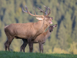
SIGHTSEEING: Altenfelden Wildlife Park
With the free app outdooractive you can hike the trail by navigation.
- All weather
- Pets allowed
- Spring
- Summer
- Autumn
Please get in touch for more information.
Veldenstraße 3
4121 Altenfelden
Phone +43 5 07263 - 200
E-Mail boehmerwald@muehlviertel.at
Web www.muehlviertel.at
https://www.muehlviertel.at
You can also visit us on
Visit us on Facebook Visit us on Instagram Visit our videochannel on YouTubeInteractive elevation profile
Create PDF
Tour-Details
Path number: 22
Starting place: 4121 Altenfelden
Destination: 4121 Altenfelden
duration: 3h 17m
length: 11,2 km
Altitude difference (uphill): 267m
Altitude difference (downhill): 261m
Lowest point: 399m
Highest point: 604m
difficulty: medium
condition: medium
panoramic view: Individual Views
Paths covering:
Asphalt, Gravel, Hiking trail, Other
powered by TOURDATA