

Schallenbergerweg


- pets allowed
- Suitable for families
- culinary interesting
- culturally interesting
- Flatly
- Possible accommodation
Interactive elevation profile
Create PDF
Tour-Details
Starting place: 4116 St. Ulrich im Mühlkreis
Destination: 4116 St. Ulrich im Mühlkreis
duration: 1h 55m
length: 6,6 km
Altitude difference (uphill): 156m
Altitude difference (downhill): 155m
Lowest point: 526m
Highest point: 624m
difficulty: easy
condition: easy
panoramic view: Great panorama
Paths covering:
Hiking trail
powered by TOURDATA
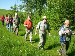
This harmoniously designed hiking trail has it all - from relaxed walking on the panoramic stretches to the auditory experience next to the rushing stream and marching through the fragrant forest.
Trail surface: tarmac, forest and meadow path
With the free outdooractive app, you can hike the trail using navigation.
Trail surface: tarmac, forest and meadow path
With the free outdooractive app, you can hike the trail using navigation.
- Free entry
- Suitable for groups
- Suitable for schools
- Suitable for kids (3 - 14 Year)
- Pets allowed
- Suitable for teenagers
- Suitable for seniors
- Suitable for single travelers
- Suitable for families
- Suitable for friends
- Suitable for couples
- Suitable for children
- Spring
- Summer
- Autumn
Not suitable for wheelchairs. The property is not compliant with Austria's ÖNORM legal standard.
4116 St. Ulrich im Mühlkreis
Phone +43 7282 6213
Fax machine +43 7282 6213 - 14
E-Mail gemeindeamt@st-ulrich.ooe.gv.at
Web www.st-ulrich.ooe.gv.at
http://www.st-ulrich.ooe.gv.at
Interactive elevation profile
Create PDF
Tour-Details
Starting place: 4116 St. Ulrich im Mühlkreis
Destination: 4116 St. Ulrich im Mühlkreis
duration: 1h 55m
length: 6,6 km
Altitude difference (uphill): 156m
Altitude difference (downhill): 155m
Lowest point: 526m
Highest point: 624m
difficulty: easy
condition: easy
panoramic view: Great panorama
Paths covering:
Hiking trail
powered by TOURDATA