

On the way of deceleration: Experience nature in 115 days in 6 days


- Multi-day tour
- Flatly
- Possible accommodation
Interactive elevation profile
Create PDF
Tour-Details
Path number: Gelbe Schilder mit Entschleunigungs-Symbol
Starting place: 4160 Aigen-Schlägl
Destination: 4160 Aigen-Schlägl
duration: 32h 17m
length: 115,0 km
Altitude difference (uphill): 2.570m
Altitude difference (downhill): 2.573m
Lowest point: 490m
Highest point: 880m
difficulty: medium
condition: medium
panoramic view: Great panorama
Paths covering:
Asphalt, Path / trail, Gravel, Hiking trail, Other
powered by TOURDATA
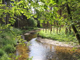
Experience nature in 6 days on 115 km
The length of the daily stages gives you enough time and leisure to enjoy the numerous rest stops along the way. Without extreme inclines and yet up to almost 1,000 metres, you will experience special natural features along the way.While hiking, you will encounter people and animals along the way in completely new ways. A week of hiking along the path of deceleration will remain a vivid memory for a long time.
Recharge your batteries with the special radiation of the granite, let the voices in your head be drowned out by the sound of the streams and "bathe" in the healthy forest air.
1st stage: Aigen-Schlägl - Haslach 19 km
2nd stage: Haslach - Helfenberg 20 km
3rd stage: Helfenberg - Rohrbach-Berg 20 km
4th stage: Rohrbach-Berg - Helfenberg 20 km. Stage: Rohrbach-Berg - Peilstein 16 km
Stage 5: Peilstein - Kohlstatt 19 km
Stage 6: Kohlstatt - Aigen-Schlägl 20 km
The route can be found digitally in the App Komoot.
On request, we will also be happy to provide you with a detailed description of the individual stages. This is also available for download under Multimedia/Documents.With the free outdooractive app, you can hike the route using navigation.
Starting point: Schlägl Abbey in Aigen-Schlägl.
Destination: Schlägl Abbey in Aigen-Schlägl.
further information:
- Multi-day tour
- Flatly
- Possible accommodation
- Experience of nature
- Board possible
Details - hiking
- themed path
1 May until 31 October
Accessibility / arrival
Directions Aigen-Schlägl
Westautobahn - Linz - B 127
Via Munich - Landshut - A92 - Deggendorf - Passau A3 - Exit
North via Wegscheid
Via Nuremberg - Regensburg A3 - Passau - exit north via Wegscheid
- Suitable for single travelers
- Suitable for couples
- Spring
- Summer
- Autumn
Please get in touch for more information.
Dreisesselbergstraße 18
4160 Aigen-Schlägl
Phone +43 5 07263 - 200
E-Mail boehmerwald@muehlviertel.at
Web www.wegderentschleunigung.at
https://www.wegderentschleunigung.at
You can also visit us on
Visit us on Facebook Visit us on Instagram Visit our videochannel on YouTube")
")
Interactive elevation profile
Create PDF
Tour-Details
Path number: Gelbe Schilder mit Entschleunigungs-Symbol
Starting place: 4160 Aigen-Schlägl
Destination: 4160 Aigen-Schlägl
duration: 32h 17m
length: 115,0 km
Altitude difference (uphill): 2.570m
Altitude difference (downhill): 2.573m
Lowest point: 490m
Highest point: 880m
difficulty: medium
condition: medium
panoramic view: Great panorama
Paths covering:
Asphalt, Path / trail, Gravel, Hiking trail, Other
powered by TOURDATA