


On the way to decleration: Schwarzenberg - Holzschlag/Klaffer, 21 km


- Possible accommodation
Interactive elevation profile
Create PDF
Tour-Details
Path number: Gelbe Schilder mit Entschleunigungs-Symbol
Starting place: 4164 Schwarzenberg am Böhmerwald
Destination: 4163 Klaffer am Hochficht
duration: 7h 3m
length: 22,0 km
Altitude difference (uphill): 820m
Altitude difference (downhill): 650m
Lowest point: 680m
Highest point: 1.370m
difficulty: difficult
condition: difficult
panoramic view: Great panorama
Paths covering:
Asphalt, Path / trail, Hiking trail
powered by TOURDATA
Stage: Schwarzenberg - Holzschlag, 21 km
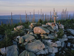
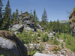
Attention: You should wear good shoes! This is a demanding stage!The steepest ascent awaits hikers on this stage, but also the most beautiful view over the three countries of Austria, Bavaria and the Czech Republic. Crossing the border triangle, you reach the highest point in the Šumava, the 1379 metre-high Plöckenstein. If you are not afraid of the detour across the border, you will be rewarded with a view of the Plöckensteinersee lake and the original Adalbert Stifter monument. The descent after the Plöckenstein is difficult. The route leads through the Hochficht ski area down into the valley to the day's destination of Holzschlag.
You can find the route digitally in the App Komoot.
On request, we will also be happy to provide you with a detailed description of the stage. This is also available for download under Multimedia/Documents.
With the free outdooractive app, you can hike the route using navigation.
further information:
- Possible accommodation
- Board possible
Details - hiking
- themed path
- Suitable for single travelers
- Suitable for couples
- Spring
- Summer
- Autumn
Please get in touch for more information.
Hauptstraße 4
4163 Schwarzenberg am Böhmerwald
Phone +43 5 7890 - 100
Fax machine +43 5 7890 - 100
E-Mail info@boehmerwald.at
Web www.wegderentschleunigung.at
https://www.wegderentschleunigung.at
You can also visit us on
Visit us on Facebook Visit us on Instagram Visit our videochannel on YouTube")
Interactive elevation profile
Create PDF
Tour-Details
Path number: Gelbe Schilder mit Entschleunigungs-Symbol
Starting place: 4164 Schwarzenberg am Böhmerwald
Destination: 4163 Klaffer am Hochficht
duration: 7h 3m
length: 22,0 km
Altitude difference (uphill): 820m
Altitude difference (downhill): 650m
Lowest point: 680m
Highest point: 1.370m
difficulty: difficult
condition: difficult
panoramic view: Great panorama
Paths covering:
Asphalt, Path / trail, Hiking trail
powered by TOURDATA