


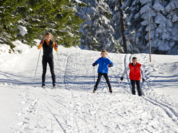
Glöckelberg cross-country ski trail


- Flatly
- Possible accommodation
Interactive elevation profile
Create PDF
Tour-Details
Path number: 8
Starting place: 4161 Ulrichsberg
Destination: 4161 Ulrichsberg
duration: 0h 30m
length: 2,1 km
Altitude difference (uphill): 70m
Altitude difference (downhill): 76m
Lowest point: 924m
Highest point: 990m
difficulty: easy
condition: easy
panoramic view: Some Views
Paths covering:
snow
powered by TOURDATA
Trail not in operation
An easy cross-country skiing track in the Bohemian Forest nordic center.Starting point is in Schöneben.
In winter, depending on snow conditions and weather.
Parking
- Parking space: 200
- Bus parking space: 10
Most economical season
- Deep winter
Please get in touch for more information.
Markt 28
4161 Ulrichsberg
Phone +43 5 7890 - 100
Fax machine +43 5 7890 - 115
E-Mail info@boehmerwald.at
Web www.boehmerwald.at
https://www.boehmerwald.at
You can also visit us on
Visit us on Facebook Visit us on Instagram Visit our videochannel on YouTube")
")
")
Interactive elevation profile
Create PDF
Tour-Details
Path number: 8
Starting place: 4161 Ulrichsberg
Destination: 4161 Ulrichsberg
duration: 0h 30m
length: 2,1 km
Altitude difference (uphill): 70m
Altitude difference (downhill): 76m
Lowest point: 924m
Highest point: 990m
difficulty: easy
condition: easy
panoramic view: Some Views
Paths covering:
snow
powered by TOURDATA