


On the way to deceleration: Rohrbach-Berg - Aigen-Schlägl, 19 km


- Possible accommodation
Interactive elevation profile
Create PDF
Tour-Details
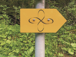
Path number: Gelbe Schilder mit Entschleunigungs-Symbol
Starting place: 4150 Rohrbach-Berg
Destination: 4160 Aigen-Schlägl
duration: 5h 20m
length: 18,6 km
Altitude difference (uphill): 560m
Altitude difference (downhill): 620m
Lowest point: 540m
Highest point: 740m
difficulty: medium
condition: medium
panoramic view: Some Views
Paths covering:
Asphalt, Gravel, Hiking trail, Other
powered by TOURDATA
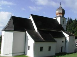
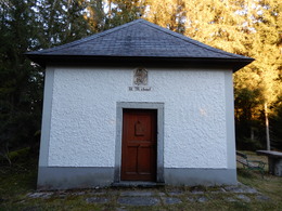
Stage: Rohrbach-Berg - Aigen-Schlägl, 19 km The Michaelskapelle chapel and the pilgrimage church of St. Wolfgang, which has been visited by countless pilgrims, await you on this stage.
You can find the route digitally in the App Komoot.
On request, we will also be happy to provide you with a detailed description of the stage. This is also available for download under Multimedia/Documents.
With the free outdooractive app, you can hike the route using navigation.
You can find the route digitally in the App Komoot.
On request, we will also be happy to provide you with a detailed description of the stage. This is also available for download under Multimedia/Documents.
With the free outdooractive app, you can hike the route using navigation.
further information:
- Possible accommodation
- Experience of nature
- Board possible
Details - hiking
- themed path
- Suitable for single travelers
- Suitable for couples
- Spring
- Summer
- Autumn
Please get in touch for more information.
Stadtplatz 1
4150 Rohrbach-Berg
Phone +43 5 7890 - 100
Fax machine +43 5 7890 - 115
E-Mail info@boehmerwald.at
Web www.wegderentschleunigung.at
https://www.wegderentschleunigung.at
You can also visit us on
Visit us on Facebook Visit us on Instagram Visit our videochannel on YouTubeInteractive elevation profile
Create PDF
Tour-Details
Path number: Gelbe Schilder mit Entschleunigungs-Symbol
Starting place: 4150 Rohrbach-Berg
Destination: 4160 Aigen-Schlägl
duration: 5h 20m
length: 18,6 km
Altitude difference (uphill): 560m
Altitude difference (downhill): 620m
Lowest point: 540m
Highest point: 740m
difficulty: medium
condition: medium
panoramic view: Some Views
Paths covering:
Asphalt, Gravel, Hiking trail, Other
powered by TOURDATA