


Relaxation and tranquility will find: Helfenberg - Rohrbach-Berg, 20 km


- Possible accommodation
Interactive elevation profile
Create PDF
Tour-Details
Path number: Gelbe Schilder mit Entschleunigungs-Symbol
Starting place: 4184 Helfenberg
Destination: 4150 Rohrbach-Berg
duration: 5h 24m
length: 20,2 km
Altitude difference (uphill): 410m
Altitude difference (downhill): 380m
Lowest point: 490m
Highest point: 690m
difficulty: medium
condition: medium
panoramic view: Great panorama
Paths covering:
Asphalt, Gravel, Hiking trail
powered by TOURDATA
Rohrbach-Berg – Peilstein
14 km, walking distance approx. 4 h, approx. 440 m difference in altitude
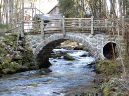
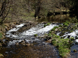
Time enough to leave everyday life behind and recharge your batteries.
Time enough to enjoy beautiful places and mystical places of power.
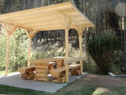
Time enough to simply "unwind" on the beautiful benches along the way.
You can find the digital route in the App Komoot.
On request, we will also be happy to provide you with a detailed description of the stage. This is also available for download under Multimedia/Documents.
With the free outdooractive app, you can hike the route using navigation.
14 km, walking distance approx. 4 h, approx. 440 m difference in altitude
Time enough to leave everyday life behind and recharge your batteries.
Time enough to enjoy beautiful places and mystical places of power.
Time enough to simply "unwind" on the beautiful benches along the way.
You can find the digital route in the App Komoot.
On request, we will also be happy to provide you with a detailed description of the stage. This is also available for download under Multimedia/Documents.
With the free outdooractive app, you can hike the route using navigation.
further information:
- Possible accommodation
- Board possible
Details - hiking
- themed path
- Suitable for single travelers
- Suitable for couples
- Spring
- Summer
- Autumn
Please get in touch for more information.
Rohrbacher Straße 2
4184 Helfenberg
Phone +43 5 7890 - 100
Fax machine +43 5 7890 - 115
E-Mail info@boehmerwald.at
Web www.wegderentschleunigung.at
https://www.wegderentschleunigung.at
You can also visit us on
Visit us on Facebook Visit us on Instagram Visit our videochannel on YouTubeInteractive elevation profile
Create PDF
Tour-Details
Path number: Gelbe Schilder mit Entschleunigungs-Symbol
Starting place: 4184 Helfenberg
Destination: 4150 Rohrbach-Berg
duration: 5h 24m
length: 20,2 km
Altitude difference (uphill): 410m
Altitude difference (downhill): 380m
Lowest point: 490m
Highest point: 690m
difficulty: medium
condition: medium
panoramic view: Great panorama
Paths covering:
Asphalt, Gravel, Hiking trail
powered by TOURDATA